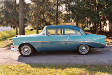
I’ve been making plans for a road trip. We haven’t been out west for over a year and it’s time. This trip will combine several destinations and we’ll be gone for just over a month. I tend to do a lot of planning for trips like this because, to tell the truth, I like that almost as much as I do the trip itself.
My father always spent time planning our family trips and we took one just about every year. In those days he had to do it the old-fashioned way, with road maps and a note pad. He always had a collection of road maps handy and we’d pick-up new ones in each state we traveled thru. My travel agent is the world-wide-web.
Back in the day we got to a town in which were going to stay the night and found a motel by neon “vacancy” sign. My parents based their choice on availability and their reaction to the looks of the place from the parking lot.
Yesterday I booked rooms in six different cities and states on-line. Before I chose a place I looked at photos of the property and read reviews. I considered which properties were most convenient to my planned route, what restaurants were near-by as well as what the rooms cost.
After a couple of hours of surfing I have confirmed reservations for rooms in Indiana, Kansas, New Mexico, Texas, Louisiana and North Carolina. I know how to get from my route of choice to my room of choice. I know how far it is between stops (an average of 573 miles) and the accumulated mileage (5159 miles). MapQuest even estimates fuel expense based on miles traveled, mpg and average gas prices ($688). How did we live before the Internet?
One of the first family trips I planned was to Colorado Springs from Phoenix back in 1971. I didn’t make lodging reservations for the one night we planned to spend on the road to Colorado because I knew we’d find a place the old-fashioned “vacancy” sign way.
There wasn’t a room available between Cortez and Colorado Springs, however, (it was Rodeo Season) and we wound up driving straight thru (777 miles according to Google maps). We arrived at 0-dark-30 the next morning and my son, who was only about a year old at the time, was sick. Elayne wasn’t happy and I haven’t left home without reservations since!
Not long after the Colorado Trip I was involved in planning another trip, this one to include the entire family, a four wheel drive caravan to Alaska! We’d all get together for Sunday dinner at my in-laws and B.S. about what we’d need to make the epic trek up and down the Alcan Highway to Alaska and back.
Around this time my Uncle Donald retired from the Alaska State Highway Department and moved to the desert near us. Naturally we invited him to our Sunday dinner and planning session. Well, Donald confirmed our notion that a lot of planning was required to drive to or from the lower 48 (that what Alaskans call the rest of the country). To illustrate he recalled the time he was unpacking the trunk of his car following a drive from Anchorage to Seattle and found he hadn’t brought a spare tire.
I know planning people will tell you that it takes careful planning to make sure you’ve got all the essentials and to eliminate the non-essentials. That’s hogwash! The more/better the planning, the more junk you’ll have, period. Uncle Donald would not have had room for Aunt Irene’s crafts (gifts for everyone in the family) if he’d planned for a flat tire. He didn’t have a flat so he didn’t need the spare!
On a couple of occasions my friend Bunkie and I traveled together. He was as opposed to planning as I was addicted to it and we worked well together. I’d do all the planning I wanted and he’d either go along with my plans or completely ignore them. When you make a plan it’s really hard not to stick to it. When you don’t do any planning at least you don’t have to worry about the plan not working. I suppose winging-it is just another way of limiting your opportunities to be disappointed.
Back in the Day
A few weeks ago I checked-out a car show at the Boonsboro American Legion Post, getting a twofer in the process; hanging out with some neat cars and their people while making my debut at the Post to which I’d recently transferred my membership. The weather, for a change, moderated and it turned out to be a great day.
There were several El Caminos in attendance and they, coupled with the “remember the war” vibe that hangs around Legion Posts, reminded me of the U-2 chase cars I watched doing their thing at Bien Hoa Air Base in Viet Nam.
The U-2 can’t land by itself because of its extreme wingspan and a bicycle (two wheels in a row) landing gear. They use “pogos” (small wheels on flexible steel legs) to support the wing tip upon landing. This requires someone to put the pogo in place when the plane touches down.
Hence the El Camino chase car and a guy in the back to handle the pogo install! The El Caminos were 1968 SS396 models that earned their keep running down the U-2s as they landed. Watching these USAF hot rods going from zero to gotcha in half the runway convinced me I really wanted an SS396 El Camino when I got back to the World!
Showing posts with label The Roads Scholar. Show all posts
Showing posts with label The Roads Scholar. Show all posts
Saturday, August 28, 2010

Tuesday, July 27, 2010
The Roads Scholar
Tuesday, July 27, 2010
“ . . . The current 55 mph limit results in prevailing speeds of about 65 mph near the Hayward Road intersection.” Frederick News-Post, June 23, 2010.
“ . . . the majority of posted speed limits in speed zones nationwide are much lower than the 85th percentile speed and in many cases lower than the average speed. . . Traffic engineers maintain . . . the limit should be set at a level at or under which 85 percent of people are driving (85th percentile).” National Motorists Association, Speed Limits, A Recommended Speed Zoning Practice.
“ . . . Some states (such as Pennsylvania) have official tolerances.” Wikipedia, Speed Limit Enforcement.
“ . . . It isn't rigidly enforced: they allow +10% +2mph in most cases.” www.safespeed.org.
According to Chaucer and damn near everyone since, “idle hands (are exploited) by the Devil.” Apparently the same goes for idle minds (never mind other body parts)!
The first four citations are just a glimpse of what I found when I got to looking into the fuss being made locally regarding the intersection of U.S.15 and Hayward Road. The last relates to what happens to me when the air is too dirty to go out and play and the heat index is over 100. In any case, the notion of “+10%+2 mph” and “85th percentile” conjures up all sorts of mischief in my obviously under-utilized mind.
You only have to drive up and down Route 15 to verify that most cars (and big trucks) are living up to expectations; driving at the posted 55 mph will get you passed like you’re standing still (if not rear-ended, run off the road or single-fingered saluted). Of course, only an old fart with nowhere to go and in no hurry to get there would even think about going the speed limit. Them and those of us driving classic cars which feel like they’re speeding at 55 mph.
The quote from the Fredrick News-Post states that a posted speed limit will cause traffic to exceed the posted speed by “about” 18%. The NMA, on the other hand, says that most speed limits are set at less than people are going to drive, that it is expected that the limit will be exceeded by 15%. This information also means that the widely accepted “tolerance” of +10%+2mph is not doing us any favors at a speed limit of 55 mph (+10%+2 mph= 62.5 mph). They are expecting us to drive 63.5 (+15%) to 65 (+18%) and allowing us to drive 62.5. We seem to be playing with house money. Except, of course, in the case of Route 15 where nobody seems to be doing much enforcing anyway.
What if we were to apply these built-in margins for excess to other areas of our lives. We could, for instance, understate our income (or overstate our refunds) by 15-18% or 10%+$2 on our tax returns with impunity. That would certainly result in a tidy windfall for taxpayers but probably significantly skew government revenue projections. That’s assuming they haven’t already built in equivalent fudge-factors and make out like bandits if we behave ourselves.
It is a good thing that the wiggle room built into speed limits is not carried-over to other things we measure (I hope). I don’t want to get only 85% of the gas I buy when I fill-up, or pay +10%+$.02 for the gallons I actually get. That would raise the price of a $2.95 gallon to $3.27 or seriously distort my mpg calculations. Now that I think of it, that’s probably exactly how gas mileage estimates are determined!
How do you think newly re-built engines would work if machinists applied these tolerances to our bores and strokes, bearings, etc. Or if a ±10%±2 standard were applied when the points you were awarded by the car show judges were tallied. OK, I guess if you got the + and the other guy got the -. Maybe that’s the answer; if the fudge factor favors you it’s not so bad, if it favors the other guy it ain’t so good.
I certainly don’t want to find out that the fudge factor is built into my blood pressure reading or my temperature (that would make normal anywhere between 87 and 110, either one of which probably means I’m dead). Overall I think I like precision measurements of all things affecting my health. I don’t think I take much comfort in a prognosis that the Doctor is only 85% sure I’ll be around for my next physical.
I really don’t mind that my old car is only 85% done because, at that point I can say I’ve finished. And I accept that, when calculating the cost of fixing-up the car easily cost +10%+$2K more than I willing to admit to spending. Tolerance is really subjective when it comes to the things we measure. I guess the best lesson to take from all of this is that we should always assume that anything anyone tells us, expects of us, or gives us is likely to have some kind of 85%/+10%+2 fudge factor built in and that we’d best assume the bias is against us.
We live in the Information Age, that is the commodity in which we deal. It is starting to look like information is going to have to have a label just like the stuff we get off the shelf in the grocery store. We need to know what percent of what we’re getting is fact and what percent is fudge factor. The information in this piece, for example; is certified (by me) to contain no more than 51% balderdash (with a ±10%±2 margin for wild imagination).
“ . . . The current 55 mph limit results in prevailing speeds of about 65 mph near the Hayward Road intersection.” Frederick News-Post, June 23, 2010.
“ . . . the majority of posted speed limits in speed zones nationwide are much lower than the 85th percentile speed and in many cases lower than the average speed. . . Traffic engineers maintain . . . the limit should be set at a level at or under which 85 percent of people are driving (85th percentile).” National Motorists Association, Speed Limits, A Recommended Speed Zoning Practice.
“ . . . Some states (such as Pennsylvania) have official tolerances.” Wikipedia, Speed Limit Enforcement.
“ . . . It isn't rigidly enforced: they allow +10% +2mph in most cases.” www.safespeed.org.
According to Chaucer and damn near everyone since, “idle hands (are exploited) by the Devil.” Apparently the same goes for idle minds (never mind other body parts)!
The first four citations are just a glimpse of what I found when I got to looking into the fuss being made locally regarding the intersection of U.S.15 and Hayward Road. The last relates to what happens to me when the air is too dirty to go out and play and the heat index is over 100. In any case, the notion of “+10%+2 mph” and “85th percentile” conjures up all sorts of mischief in my obviously under-utilized mind.
You only have to drive up and down Route 15 to verify that most cars (and big trucks) are living up to expectations; driving at the posted 55 mph will get you passed like you’re standing still (if not rear-ended, run off the road or single-fingered saluted). Of course, only an old fart with nowhere to go and in no hurry to get there would even think about going the speed limit. Them and those of us driving classic cars which feel like they’re speeding at 55 mph.
The quote from the Fredrick News-Post states that a posted speed limit will cause traffic to exceed the posted speed by “about” 18%. The NMA, on the other hand, says that most speed limits are set at less than people are going to drive, that it is expected that the limit will be exceeded by 15%. This information also means that the widely accepted “tolerance” of +10%+2mph is not doing us any favors at a speed limit of 55 mph (+10%+2 mph= 62.5 mph). They are expecting us to drive 63.5 (+15%) to 65 (+18%) and allowing us to drive 62.5. We seem to be playing with house money. Except, of course, in the case of Route 15 where nobody seems to be doing much enforcing anyway.
What if we were to apply these built-in margins for excess to other areas of our lives. We could, for instance, understate our income (or overstate our refunds) by 15-18% or 10%+$2 on our tax returns with impunity. That would certainly result in a tidy windfall for taxpayers but probably significantly skew government revenue projections. That’s assuming they haven’t already built in equivalent fudge-factors and make out like bandits if we behave ourselves.
It is a good thing that the wiggle room built into speed limits is not carried-over to other things we measure (I hope). I don’t want to get only 85% of the gas I buy when I fill-up, or pay +10%+$.02 for the gallons I actually get. That would raise the price of a $2.95 gallon to $3.27 or seriously distort my mpg calculations. Now that I think of it, that’s probably exactly how gas mileage estimates are determined!
How do you think newly re-built engines would work if machinists applied these tolerances to our bores and strokes, bearings, etc. Or if a ±10%±2 standard were applied when the points you were awarded by the car show judges were tallied. OK, I guess if you got the + and the other guy got the -. Maybe that’s the answer; if the fudge factor favors you it’s not so bad, if it favors the other guy it ain’t so good.
I certainly don’t want to find out that the fudge factor is built into my blood pressure reading or my temperature (that would make normal anywhere between 87 and 110, either one of which probably means I’m dead). Overall I think I like precision measurements of all things affecting my health. I don’t think I take much comfort in a prognosis that the Doctor is only 85% sure I’ll be around for my next physical.
I really don’t mind that my old car is only 85% done because, at that point I can say I’ve finished. And I accept that, when calculating the cost of fixing-up the car easily cost +10%+$2K more than I willing to admit to spending. Tolerance is really subjective when it comes to the things we measure. I guess the best lesson to take from all of this is that we should always assume that anything anyone tells us, expects of us, or gives us is likely to have some kind of 85%/+10%+2 fudge factor built in and that we’d best assume the bias is against us.
We live in the Information Age, that is the commodity in which we deal. It is starting to look like information is going to have to have a label just like the stuff we get off the shelf in the grocery store. We need to know what percent of what we’re getting is fact and what percent is fudge factor. The information in this piece, for example; is certified (by me) to contain no more than 51% balderdash (with a ±10%±2 margin for wild imagination).
Saturday, April 24, 2010
The Roads Scholar
By Carroll G Anderson
April, 2010
A century ago the United States had 2.5 million miles of roads, none of them paved. Less than half the streets in New York City were paved at the time. Around the same time the automobile was coming into its own and needed something besides mud, dust and ruts to really strut its stuff. Popular movements to connect American cities with real all weather roads had been developing over the past couple of decades but, in 1910, the American Road was pretty much just a dream.
Around the same time, in a totally unrelated (then or now) occurrence, the fortune of a British big-shot named Cecil Rhodes was used to fund the Rhodes Scholarship. It has become one of the world’s most prestigious scholarly awards and has been won by a number of famous Americans including Bill Clinton and Kris Kristofferson. Although I’m not a Rhodes Scholar and have never been to Oxford, Mississippi let alone Oxford and Cambridge Universities (where Rhodes Scholars study), I consider myself a true Roads Scholar.
While I’ve been interested in doing what you do on roads all my life: a road trip is entertainment of the finest kind as far as I’m concerned, I just recently became interested in the story of roads. When we moved to Middletown, Maryland we moved into a neighborhood bordered by the Old National Pike; a quarter mile from our front door the street on which we live intersects with one of America’s most historic roads.
U.S Route 40 was built along the route of the National Road, the first Federally funded road built to connect cities on the eastern seaboard with the Ohio River. That road was built to take advantage earlier cross-country efforts including Braddock’s Road from Cumberland, Maryland to Pittsburg, Pennsylvania. Braddock’s Road, built during the French and Indian Wars to enable colonial British forces to get to French military outposts in Western Pennsylvania, was itself build along Indian trails established by centuries of foot traffic between coastal tribes and those on the other side of the Appalachians.
In 1912 a coast-to-coast road, the National Old Trails Road or Ocean-to-Ocean Highway, was established. The 2,448 mile route incorporated the Old National Pike and the Santa Fe Trail as well as Indian Trails. Beginning in Baltimore and ending in Los Angeles, the Ocean-to-Ocean Highway had a long and storied career: less than 800 of those miles were ever paved, it was always tough to negotiate and it eventually became part of U.S. Route 40, U.S. Route 66, and, finally, parts of both Interstate 40 and Interstate 70.
While early travelers were bouncing along over the O-2-O the Nation was being dragged kicking and screaming into the 20th century by legislation that ultimately put the paving of America’s roads into the hands of the Federal government. By the mid-20’s the development of America’s highways was well underway. The “0” routes like 30 & 40 began connecting States east to west and vice versa. The “1” routes handled traffic traveling north and south. The numbering system was put in place at least in part to alleviate the confusion resulting from “naming” roads.
Named roads, while far more colorful than numbered routes, proved to be a handful; hard to agree upon and hard to remember. The Dixie Overland Highway, for instance, ran from Savannah, Georgia to San Diego, California while the King of Trails Highway carried travelers from Winnipeg, Canada to Brownsville, Texas. Even at the relatively slow speeds of 1925 it could take several road signs to read those names. Of course there weren’t too many alternatives to take a wrong turn onto.
Eventually many of the named cross-country roads became numbered U.S. Routes and finally Interstate Highways. Thinking about traveling across the country on graded (maybe) dirt roads, following signs painted on power or telephone poles, or roadside barns, certainly would enhance the adventure. But how much enhancement does your adventure need when it already involved riding for days in a Model T?
I’ve been around long enough to remember cross country trips on dirt roads, the two lane blacktop that replaced them and finally Interstates that go the same place. I gotta say, for covering a lot of distance in as little time as possible, nothing beats the Interstate. At the same time, if you want to see the country the two lane blacktop is the answer. Dirt roads, on the other hand, are what I call “off-roading.”
Every year or so I get an undeniable urge to cross the country and, regardless of the final destination, I take the Interstate. Almost weekly I get a smaller scale road trip urge I assuage with a ride on two-lane blacktop, almost never getting on the Interstate (until I have to kick it up a notch because I have to get home to the potty). Much less frequently these days I get an “off-roading” jones. In the first place, “off-roading” around here is apt to involve trespassing. Secondly, as I get older, I find myself more prone to “shaken geezer syndrome.” The more fun hurts, the easier it is to give up!
April, 2010
A century ago the United States had 2.5 million miles of roads, none of them paved. Less than half the streets in New York City were paved at the time. Around the same time the automobile was coming into its own and needed something besides mud, dust and ruts to really strut its stuff. Popular movements to connect American cities with real all weather roads had been developing over the past couple of decades but, in 1910, the American Road was pretty much just a dream.
Around the same time, in a totally unrelated (then or now) occurrence, the fortune of a British big-shot named Cecil Rhodes was used to fund the Rhodes Scholarship. It has become one of the world’s most prestigious scholarly awards and has been won by a number of famous Americans including Bill Clinton and Kris Kristofferson. Although I’m not a Rhodes Scholar and have never been to Oxford, Mississippi let alone Oxford and Cambridge Universities (where Rhodes Scholars study), I consider myself a true Roads Scholar.
While I’ve been interested in doing what you do on roads all my life: a road trip is entertainment of the finest kind as far as I’m concerned, I just recently became interested in the story of roads. When we moved to Middletown, Maryland we moved into a neighborhood bordered by the Old National Pike; a quarter mile from our front door the street on which we live intersects with one of America’s most historic roads.
U.S Route 40 was built along the route of the National Road, the first Federally funded road built to connect cities on the eastern seaboard with the Ohio River. That road was built to take advantage earlier cross-country efforts including Braddock’s Road from Cumberland, Maryland to Pittsburg, Pennsylvania. Braddock’s Road, built during the French and Indian Wars to enable colonial British forces to get to French military outposts in Western Pennsylvania, was itself build along Indian trails established by centuries of foot traffic between coastal tribes and those on the other side of the Appalachians.
In 1912 a coast-to-coast road, the National Old Trails Road or Ocean-to-Ocean Highway, was established. The 2,448 mile route incorporated the Old National Pike and the Santa Fe Trail as well as Indian Trails. Beginning in Baltimore and ending in Los Angeles, the Ocean-to-Ocean Highway had a long and storied career: less than 800 of those miles were ever paved, it was always tough to negotiate and it eventually became part of U.S. Route 40, U.S. Route 66, and, finally, parts of both Interstate 40 and Interstate 70.
While early travelers were bouncing along over the O-2-O the Nation was being dragged kicking and screaming into the 20th century by legislation that ultimately put the paving of America’s roads into the hands of the Federal government. By the mid-20’s the development of America’s highways was well underway. The “0” routes like 30 & 40 began connecting States east to west and vice versa. The “1” routes handled traffic traveling north and south. The numbering system was put in place at least in part to alleviate the confusion resulting from “naming” roads.
Named roads, while far more colorful than numbered routes, proved to be a handful; hard to agree upon and hard to remember. The Dixie Overland Highway, for instance, ran from Savannah, Georgia to San Diego, California while the King of Trails Highway carried travelers from Winnipeg, Canada to Brownsville, Texas. Even at the relatively slow speeds of 1925 it could take several road signs to read those names. Of course there weren’t too many alternatives to take a wrong turn onto.
Eventually many of the named cross-country roads became numbered U.S. Routes and finally Interstate Highways. Thinking about traveling across the country on graded (maybe) dirt roads, following signs painted on power or telephone poles, or roadside barns, certainly would enhance the adventure. But how much enhancement does your adventure need when it already involved riding for days in a Model T?
I’ve been around long enough to remember cross country trips on dirt roads, the two lane blacktop that replaced them and finally Interstates that go the same place. I gotta say, for covering a lot of distance in as little time as possible, nothing beats the Interstate. At the same time, if you want to see the country the two lane blacktop is the answer. Dirt roads, on the other hand, are what I call “off-roading.”
Every year or so I get an undeniable urge to cross the country and, regardless of the final destination, I take the Interstate. Almost weekly I get a smaller scale road trip urge I assuage with a ride on two-lane blacktop, almost never getting on the Interstate (until I have to kick it up a notch because I have to get home to the potty). Much less frequently these days I get an “off-roading” jones. In the first place, “off-roading” around here is apt to involve trespassing. Secondly, as I get older, I find myself more prone to “shaken geezer syndrome.” The more fun hurts, the easier it is to give up!
Subscribe to:
Posts (Atom)